I found several maps that show interesting info that I wanted to share:
Includes, earthquake prone areas, volcanic hazards,
nuclear fallout areas, earth change maps, and more.
Sources of these Maps
Some maps and images are from government publications or websites, some were found in the newsgroup alt.binary.astro and other websites.
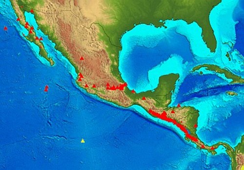
Vulcanic Hazard Map
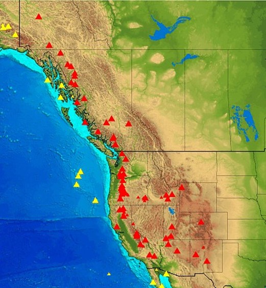 |
|
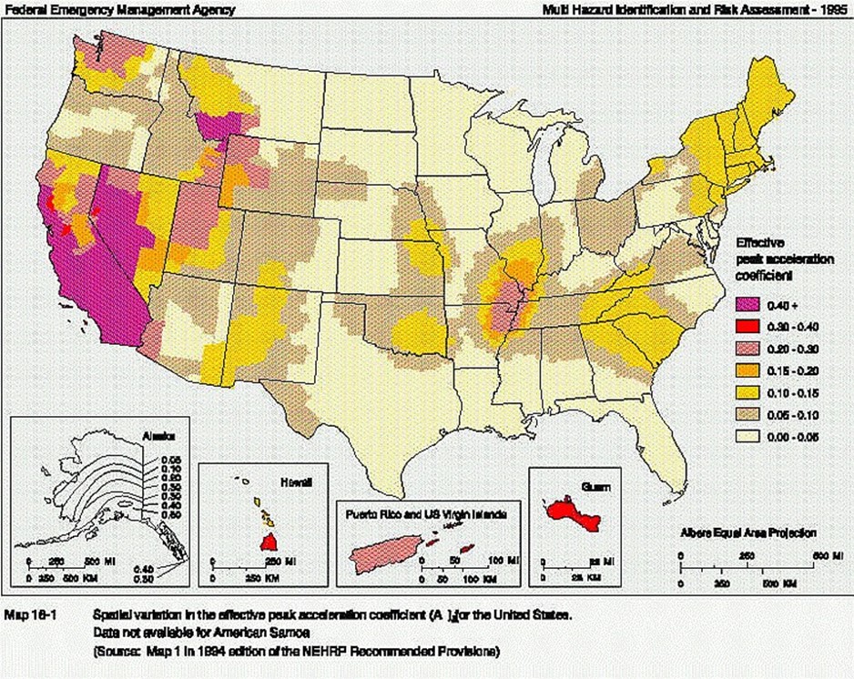
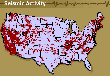
Earthquakes
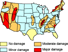
Source: http://www.kgs.ku.edu/Extension/image/earthquake3.html
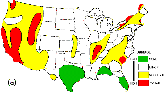
Source: http://www.mgs.md.gov/esic/brochures/earthquake.html
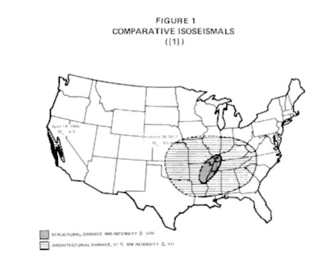
Comparison of damage and destruction of 1906 San Francisco,
1811-12 New Madrid, and 1880’s Charleston Earthquakes.
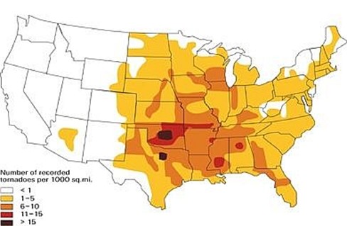
Tornado Risk Map
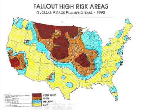
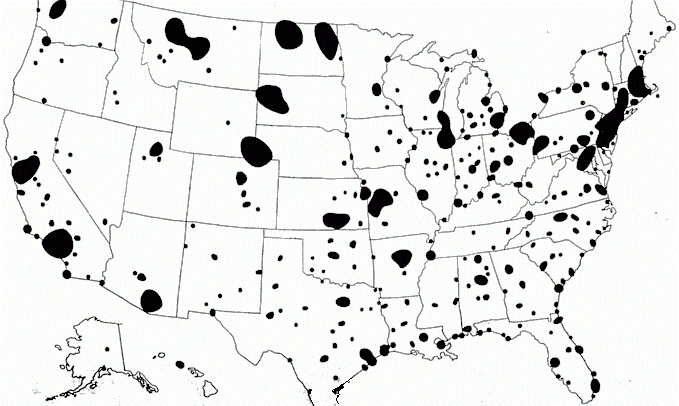
Nuclear targets and Fallout areas
1990 FEMA Report on Possible fallout regions after nuclear attack
Nuclear targets based on known defense, value of target, population, and military sites
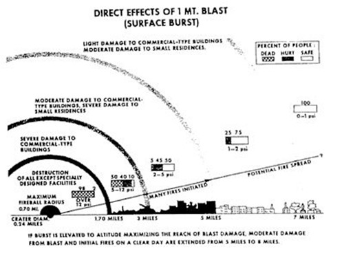
Effects of a ONE megaton nuclear detonation
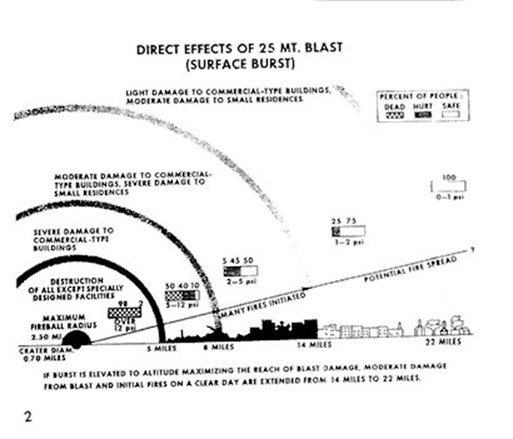
Effects of a 25 megaton nuclear detonation
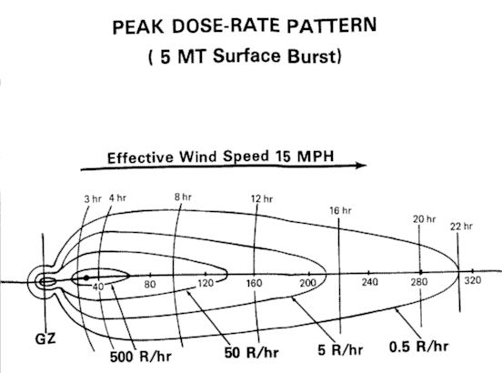
Downwind radiation dose-rate after nuclear detonation
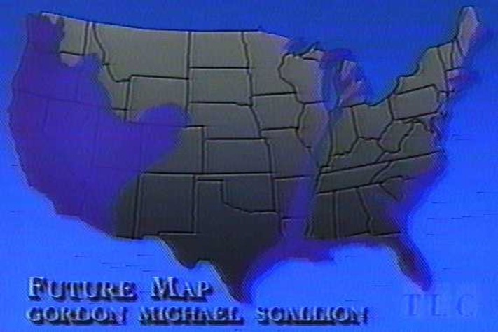
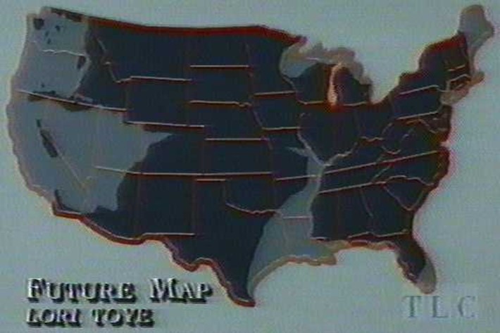
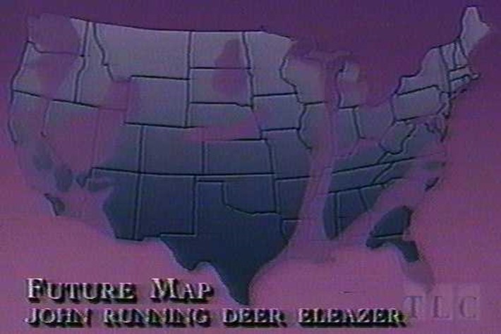
Maps of the US after predicted EARTH CHANGES
Gordon Michael Scallion
Lori Toye
John Running Deer Eleazer
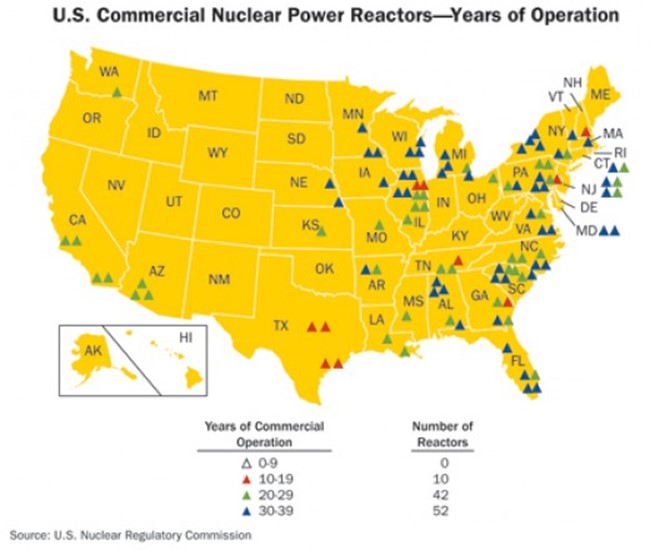
http://enni82.hubpages.com/hub/Nuclear-Power-Nuclear-Power-in-the-US-Nuclear-Next-Door#
http://enni82.hubpages.com/hub/Nuclear-Power-Nuclear-Power-in-the-US-Nuclear-Next-Door#
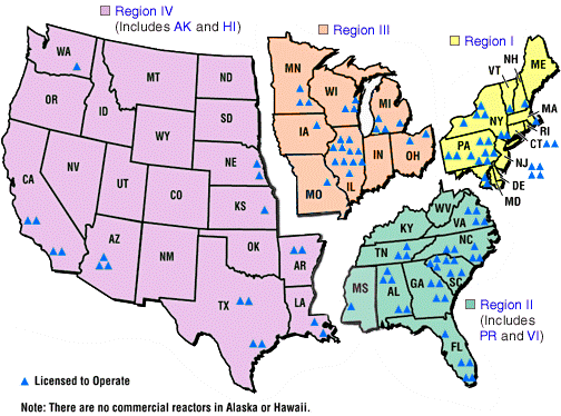
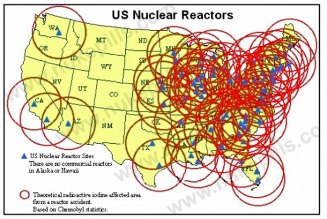
http://commons.wikimedia.org/wiki/File:Nrc_reactors_map.gif
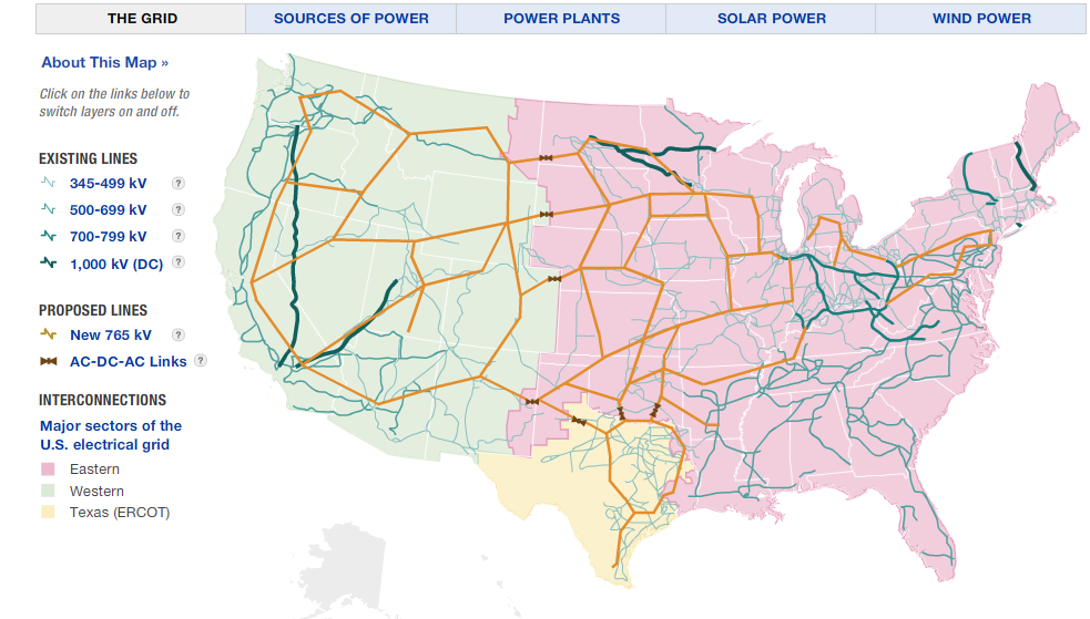
http://www.npr.org/2009/04/24/110997398/visualizing-the-u-s-electric-grid
Start now to make sure you are staying prepared.


 Follow
Leave a Reply