Ok, we’ve talked about the pace count and how to measure it and now it’s actually time to use it. So how exactly do we do that?
When you plot a route on a map you have to take into consideration obstacles such as rivers, mountains, swamps, etc. Very rarely will you ever go straight from where you are to your destination. Instead you’ll set up a series of routes called “legs.”
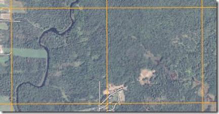
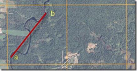
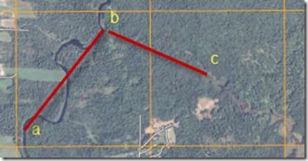
A leg is one segment of a journey such as from point A to point B on the map below. If you’re plotting a trip using a map you want to plot your route in such a way that you avoid obstacles. Lets say you start at point a on the river, then walk up river for a while until point b, then at point b you turn into the woods for the final leg to your destination in the clearing.
How do you know when to leave the river and turn inland for the final leg?
If you measure the straight line distance between the two points it’s only 900 meters, but you can tell by looking at the map that the actual distance traveled will be more than that because the river twists and turns.
How do we measure those twists and turns?
Point b is important because it’s where you leave the river in order to get to the clearing (point c). If you go too far north you’ll walk past the clearing (point c) that you’re aiming for because you’ll over shoot.
To figure out the distance using the scale below, take a piece of scrap paper and mark out the increments from 1 to 1000 meters on the paper. Then use that piece of paper to get the actual ground distance you’ll be traveling.
Check out the short video below on how to measure ground distance.
Measuring Ground Distance On a Map
As you can see from the video the straight line distance is 900 meters, but the actual distance you need to travel is 1.4 kilometers or 1400 meters. Following a river here is fairly rough terrain (I’ve actually walked a little piece of the river in this map), so I’d probably go with 100 meters = 75 paces average from the last post.
Keeping Track of Your Distance
As you walk you’ll need to find a way to keep track of how far you’ve gone. There are Ranger Beads that can help you keep track of how far you’ve gone, which I’ve used in the past.
One of the things I do most often is just stop and pick up a small twig or a pebble and hold onto it after walking 100 meters or 75 paces, then I start counting over from 1. After I’ve got ten of them in my hand I know I’ve walked a kilometer and I start over again knowing I’ve got 1 kilometer behind me.
Thus, if I were walking the course above I’d look for a couple of different things. First, I’d make sure I had at least 14 pebbles in my hand (1.4 kilometers) and second, I’d look to make sure I was at a bend in the river where the bend was heading almost due north.
If these things were true then I’d get out my compass and follow the azimuth towards point c.
Orienteering series
Why Should I Learn Map Reading?
Understanding the Topographic Map
Discussion of Grid and Magnetic Azimuths
Start now to make sure you are staying prepared.
Via: shtfblog


 Follow
Leave a Reply